The Great Lakes Coastal Storms Program was a recently concluded regional effort led by the National Oceanic and Atmospheric Administration (NOAA) to make Great Lakes coastal communities safer and more resilient to storm and weather hazards and climate change. Partnering with the Great Lakes Sea Grant Network, the Coastal Storms Program funded projects in the Great Lakes with the long-lasting goals of:
- improving dangerous current and wave observations, modeling, forecasting/warnings and risk communication;
- addressing the impacts of stormwater on natural resources and promoting best management practices;
- enhancing shoreline mapping, visualization and management; and
- promoting hazard mitigation and community resilience.
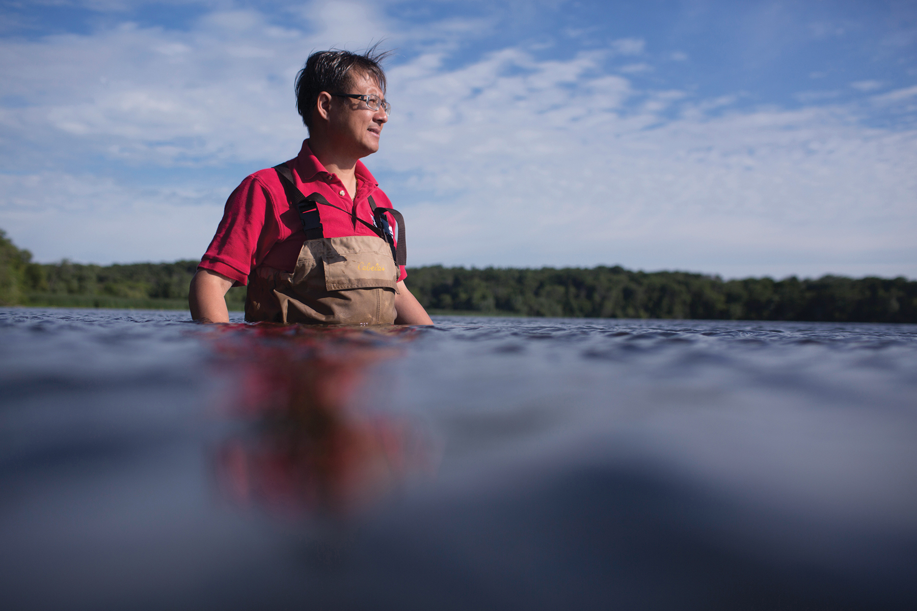
Co-led by Chin Wu, SeaCavesWatch.org is a real-time wave observation system designed to prevent kayaking tragedies. Credit: Matt Jones.
News
Lake Michigan’s Most Popular Weather Buoy Brought Ashore for Winter (10/23/14)
Launched in 2012, the Port Sheldon buoy has quickly become the leader in weather information in the Great Lakes. Ed Verhamme, project engineer at LimnoTech, noted that, “the Port Sheldon unit is the most popular weather site in Lake Michigan with more than 1 million requests for information this year, double the next highest site.” Supported through a grant from the Coastal Storms Program and through the Great Lakes Observing System, the buoy measures wind speed, wind direction, air temperature, relative humidity, solar radiation, water temperature, wave height, period and direction. It also has a webcam. The buoy was removed from the lake on October 22, 2014. Read the full article or check out the buoy data portal.
Lake Michigan Death Spurs Action on Rip Current Awareness (8/24/14)
Spurred by the tragic death of a Port Washington, WI high schooler in 2012, UW-Madison coastal hazards researcher, Dr. Chin Wu, is developing a warning system that will help raise awareness and prevent deaths from dangerous rip currents in Great Lakes beach communities. Through a $200,000 Coastal Storms Program grant, Wu will be installing thermal imaging cameras on two Lake Michigan beaches that will provide real-time rip current information to beach managers. See the full story.
Great Lakes Mobile Beach App to be Enhanced (05/29/14)
The Great Lakes Commission receives funds to develop iOS version of myBeachCast through Coastal Storms Program, in partnership with the Great Lakes Sea Grant Network. The Great Lakes mobile beach app provides updates to latest swim advisories, weather conditions and hazard alerts for more than 2,000 beaches in the region. See the press release and download the android app.
Lake Erie Weather Buoy Deployed Off Presque Isle (05/06/14)
Regional Science Consortium Tom Ridge Environmental Center deploys its new weather buoy funded through the Great Lakes Observing System, in partnership with the Coastal Storms Program. Watch the video. Check out the consortium’s real-time buoy information.
Port Sheldon, Michigan, Welcomes Back its Offshore Weather Buoy (05/05/14)
Lake Michigan swimming season still a ways off! Local Storm Team 8 features the Port Sheldon Buoy weather cam, watch the video. The Port Sheldon buoy is owned and operated by LimnoTech and supported by the Great Lakes Observing System in partnership with the Coastal Storms Program.
Great Lakes Sea Grant Network Projects
Dangerous Current and Wave Risk Communication
In 2012 and 2013, dangerous currents and waves in the Great Lakes caused 88 drowning deaths and rescue incidents. Increased beachgoer awareness and better decision making is needed to prevent the further loss of life from these swimming hazards. In order to address this risk communication gap, the Coastal Storms Program contracted Eastern Research Group (ERG) to study beachgoer attitudes and perceptions related to dangerous currents and waves along several popular beaches in the Great Lakes. The report is the culmination of multiple years of regional beach expert and practitioner interviews, web-based and beach intercept surveys, an extensive literature search, and partner coordination. In the report, ERG outlines a comprehensive risk communication strategy, which includes the creation of a community of practice where a wide range of organizations working for beach safety in the Great Lakes can exchange ideas and promote consistent safety messages. See the full report. For more information please contact Jesse Schomberg at jschombe@d.umn.edu or (218) 726-6182.
Great Lakes Coastal Hazards Planning, Mitigation and Resilience Survey
Coastal communities in the Great Lakes are faced with several storm hazards, including bluff and shoreline erosion, runoff pollution and flooding. The increasing frequency and severity of weather events make planning for coastal storm hazards an important component in helping Great Lakes communities become more resilient to climate change. The University of Wisconsin Sea Grant Institute, in conjunction with the NOAA Great Lakes Coastal Storms Program, conducted a survey to learn the planning and implementation needs of Great Lakes coastal planners and managers to mitigate and adapt to coastal storm hazards. Survey results are being used to develop and target outreach, products and tools that will help Great Lakes communities prepare for coastal storm hazards. For more information about this report, please contact Julia Noordyk at noordykj@uwgb.edu or 920-465-2795.
Small Grant Projects
myBeachCast: Improving Great Lakes Beach Hazard Awareness
Project Lead: Great Lakes Commission – Christine Manninen
Partners: LimnoTech
Geographic Scope: Great Lakes
The myBeachCast app currently allows Great Lakes beachgoers to view real-time beach information on android devices, including water quality advisories, weather and water conditions. This project will extend the capabilities of myBeachCast to the iOS (Apple-iPhone) platform, potentially doubling the user rate. In addition, streamlined online and mobile reporting methods will be developed to allow the integration of beach condition reports into myBeachCast. This will enable users of myBeachCast to instantly access local beach conditions such as wave heights, water temperatures and flag status, as reported by lifeguards and beach supervisors.
Implementing Dangerous Currents Best Practices
Project Lead: Michigan Sea Grant College Program– Jim Diana
Partners: Illinois-Indiana Sea Grant College Program, Illinois State Coastal Management Program, Indiana Lake Michigan Coastal Program, Michigan Coastal Management Program, University of Wisconsin Sea Grant Institute, Wisconsin Coastal Management Program
Geographic Scope: Illinois, Indiana, Michigan, Minnesota, Ohio and Wisconsin
Dangerous waves and currents are the number one risk to recreational water users in the Great Lakes. This project will address the pressing need to raise awareness on how to recognize and respond to dangerous currents and will provide the latest products that can help save lives. The project will also develop long-term strategies that incorporate regional collaboration, as well as the latest technology into beach hazard messaging and outreach. Project managers will create new, consistent messages around dangerous currents and waves for Great Lakes beaches based on past experience and recent research. Beach safety equipment (e.g., life jackets, throw rings, throw bags, and rescue boards) will also be distributed along Great Lakes beaches with additional risk communication materials.
Development of an Observation, Forecasting, and Warning System for Rip Currents at Three Beaches in Lake Michigan and Lake Superior
Project Lead: University of Wisconsin-Madison – Chin Wu
Partners: Minnesota Sea Grant College Program, NOAA/National Ocean Service, University of Wisconsin Sea Grant Institute
Geographic Scope: Duluth, MN; Milwaukee, WI and Port Washington, WI
Real-time observations of rip currents are currently not available for the shorelines in Lake Superior and Lake Michigan. This project will use innovative beach hazard forecasting technology to improve rip current identification, forecasting and public notification. Video-imaging will allow for identification and detection of hazardous wave conditions. Computer models will be applied to the beaches, which will allow researchers to better predict hazardous wave conditions. Three rip-current-prone beaches are being targeted, including Bradford Beach (Milwaukee, WI), North Beach (Port Washington, WI), and Park Point Beach (Duluth, MN). Project members will coordinate with local communities to apply the results of the project to improve the management and public safety at their beaches, and increase public awareness about dangerous waves and currents in the Great Lakes.
Flood Smart Communities
Project Lead: The Nature Conservancy New York – Stevie Adams
Partners: Genesee/Finger Lakes Regional Planning Council, State University of New York, State University of New York – College of Environmental Science and Forestry, University at Buffalo
Geographic scope: Greece, NY; Hilton, NY and Parma, NY
Regular flooding in Monroe County, NY, has been documented since 1865. The very low slopes of lake plain topography and wet climate have always presented a challenge to these communities for draining the surface runoff generated by even small rain events. The primary goal of this project is to work with coastal municipalities in Monroe County to reduce their flooding vulnerability, improve water quality, and increase their resiliency to climate change to benefit human and ecological communities. A vulnerability assessment and economic analysis will help inform the development of a Floodplain Action Plan, which will list specific steps for the community to take to protect people and nature. This plan will reflect the connection of upstream and downstream communities and will incorporate land use planning and regulation, Smart Growth principles, green infrastructure techniques, water resource sustainability and climate change adaptation.
Increasing Climate Resiliency in Coastal Ohio Using Green Infrastructure
Project Lead: Chagrin River Watershed Partners, Inc. – Amy Brennan
Partners: North Carolina State University, Ohio Department of Natural Resources Division of Wildlife -Old Woman Creek NERR, Ohio Department of Natural Resources – Division of Soil and Water Resources
Geographic scope: Cuyahoga County, OH and Lake County, OH
Since 2006, Lake County in northeastern Ohio has endured both 250-year and 500-year storm events. One community experienced flooding of over 70% of the residential structures due to undersized stormwater infrastructure. This project seeks to improve the green infrastructure planning and implementation that can help reduce runoff volumes, limit damages and help Lake County communities recover more quickly from heavy precipitation events. Using future climate modeling projections, the Chagrin River Watershed Partners (CRWP) will update their existing model codes for riparian setbacks, comprehensive stormwater management, and flood damage reduction. CRWP will then work with communities to adopt these updated codes. North Carolina State University will use a model (DRAINMOD) to determine which bioretention and permeable pavement designs will perform best under predicted and extreme climate change rainfall scenarios. The Ohio Department of Natural Resources will use the model results to evaluate the design guidance in the Rainwater and Land Development Manual.
A Model for Community-Supported Observations: City of South Haven, MI
Project Lead: LimnoTech – Ed Verhamme
Partners: City of South Haven
Geographic Scope: Southwestern Michigan and northern Indiana
The stretch of Lake Michigan shoreline between Muskegon, MI and Michigan City, IN, contains several of the most popular beaches in the Great Lakes region. While there are several offshore buoys in this region that provide valuable weather data to the local National Weather Service offices and recreational boaters, there is a 70-mile information gap between Bridgman, MI and Port Sheldon, MI. This project will improve and increase nearshore real‐time marine observations in western Michigan and northern Indiana through two main activities. First, a buoy will be deployed off the coastline of South Haven, MI, to fill the 70-mile observation gap. Second, the project leader will work with the owners and operators of the four other nearshore buoys to create a regional communication plan that will help coordinate the relay of information to local and regional water safety personnel, boaters, anglers, residents, and tourists of the seven coastal counties in western Michigan and northern Indiana.
Flood Resiliency: Evaluating Flood Hazard Identification Tools in Two Lake Champlain Basin Sub-watersheds
Project Lead: University of Vermont – Lake Champlain Sea Grant – Breck Bowden
Partners: University of Vermont – Rubenstein School of Environment and Natural Resources
Geographic Scope: Chittenden County, VT and Essex County, NY
Many towns in the Lake Champlain Basin use FEMA’s Flood Insurance Rate Maps (FIRMS) to control development in vulnerable locations. However, these maps do not indicate erosion flooding risks, which are a more common hazard in this region. To address this gap, flood information from the past 50 years will be used to compare the frequency of impacts of three different flood hazard mapping methods: FIRMS, NRCS Floodable soils layers, and FEH zones. Following this analysis, current river corridor zoning regulations will be evaluated in two Lake Champlain Basin rivers (Ausable River, NY and Winooski River, VT) to highlight the areas at increased risk for future flooding.
Development of a Coastal Storm Preparation, Adaptation, and Response Tool for Great Lakes Marinas
Project Lead: Ohio Sea Grant College Program – Sarah Orlando
Geographic Scope: Ohio, Pennsylvania and Wisconsin
The Great Lakes coastal region experienced extensive storm impacts from Superstorm Sandy, resulting in massive infrastructure failures, to loss of property and more. While hurricane preparedness plans exist for many marinas found along other coastal areas of the United States that are more regularly exposed to hurricanes and large storm events (e.g., East Coast and Gulf of Mexico), these plans may not be applicable to the types of coastal hazards faced by Great Lakes marinas. To help prepare Great Lakes marinas for the risks associated with coastal storms, a regionalized ‘coastal storms preparedness, adaptation, and response’ tool will be developed to guide marinas in implementing long-term hazard mitigation. The tool will also provide marinas with the necessary planning resources to properly respond to hazardous storm events. The final guide will be shared throughout the basin via the Great Lakes Clean Marina Network and through regional workshops.
Green Stormwater Infrastructure Planning for Lucas County
Project Lead: University of Toledo – Cyndee Gruden
Partner: American Rivers
Geographic scope: Lucas County, OH
Lucas County, OH, experienced 100-year flood events in 2006, 2008 and 2011. These events resulted in the degradation of valuable assets including infrastructure (buildings, bridges, outfalls), as well as water quality in recreational waters and drinking water sources. This project supports the development of green infrastructure planning and implementation in Lucas County by determining how to cost-effectively reduce stormwater run-off using green infrastructure. The Lucas County Sustainability Commission will consider the results of this project in the development of regional run-off reduction goals. This work will be facilitated by the Green Stormwater Infrastructure Task Force in the Lucas County region, which is made up of many partners, including representation from local government, non-governmental organizations, a local land bank, a soil and water conservation district, and academic partners.
Community-based Research to Understand Lake Superior Coastal Storms Risk and Vulnerability at Au Train, MI
Project Lead: Michigan Technological University – Guy Meadows
Partner: Alger Conservation District
Geographic scope: Au Train, MI
Between two rocky headlands at the mouth of the Au Train River along the south central Lake Superior coastline, lies a picturesque sand pocket beach adjacent to a major state highway, making this an attractive yet challenging coastal setting. Wave action, erosion and the formation of sand bars and ice dams, due to storms over Lake Superior, regularly threaten to undercut the highway. Stakeholders want to prevent an emergency situation where stabilization of the road would require a large installation of riprap, degrading the scenic beach, which is a locally valuable economic resource. This project will contribute to a cooperative, proactive plan for shoreline protection and hazard mitigation while preserving the natural system. A major focus of this effort will be the completion of a high-precision nearshore hydrographic survey, which will be used as input to the Delft3D nearshore hydrodynamic model capable of modeling 3D flows, sediment transport, waves, water quality, morphology, and ecology. The resulting model will provide a detailed picture of the coastal dynamics and associated risks to infrastructure. Risk and vulnerability assessments will also aid community planning decisions for potential mitigation and adaptation strategies to address erosion and flooding in the area.