
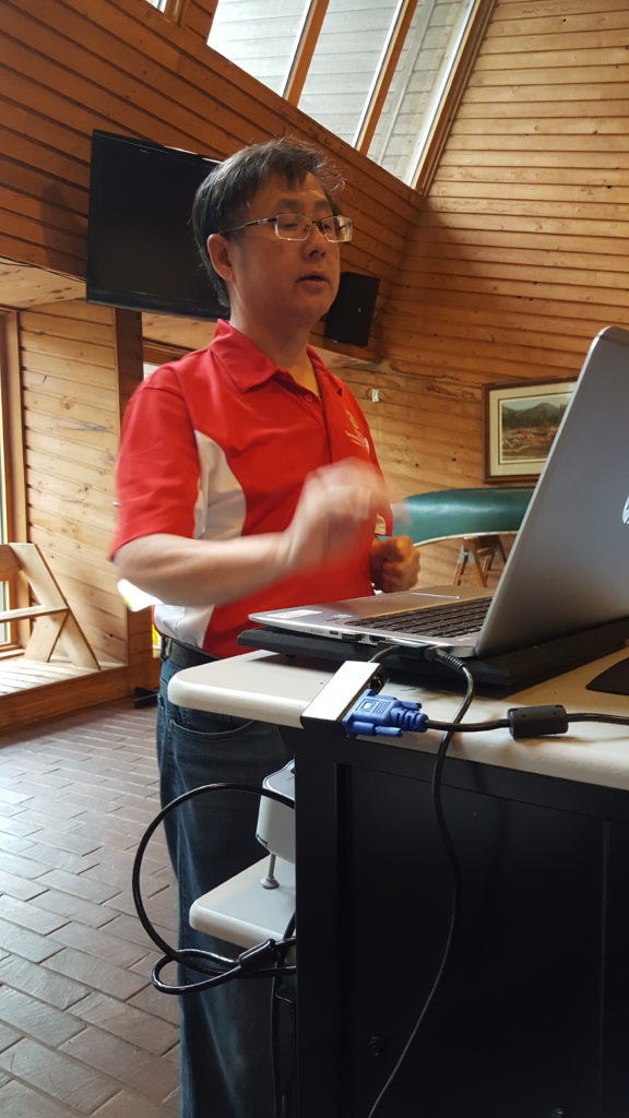
Professor Chin Wu. Image by Marie Zhuikov, Wisconsin Sea Grant.
Chin Wu is working to “build a family” to deal with dangerous currents along the South Shore of Lake Superior and on other beaches in the Great Lakes. Wu, a professor of civil and environmental engineering at the University of Wisconsin-Madison, made the comment during a dangerous currents workshop in late May in Ashland, Wisconsin.
The event drew a variety of community members from the South Shore who wanted to learn more about this hidden but potentially lethal hazard. Dangerous currents sometimes form around islands or piers and can be caused by winds and waves on beaches. Across the Great Lakes, an average of 11 drownings and 23 rescues happen related to dangerous currents every year.
The workshop, titled “Preparing for Dangerous Currents: A Workshop for South Shore Communities,” was held as part of a two-year project that involves a team from Wisconsin and Minnesota who are working to characterize dangerous currents along Lake Superior’s South Shore, determine if they can forecast the currents, and develop a framework for public safety warnings and education programs. The project is focusing on six locations along the South Shore: three on Park Point, and one each in Port Wing, the Apostle Islands and Chequamegon Bay.
During his presentation, Wu described a type of rip current that was news to me: flash rips are strong currents that form after storms on areas of the beach that usually don’t see rip currents. They flow farther out into the lake than usual, beyond the nearshore. They are difficult to predict and unlike your garden variety rip currents, no return flow of water circulates back to shore, which can drag unfortunate swimmers far out into the lake.
“Flash rips are one of the most dangerous currents we have encountered,” said Wu.
Wu and his research team are working on ways to use a computerized camera system combined with wind and wave condition information to detect flash rips so that beach-goers can be warned about them. So far, they have achieved an 82% accuracy rate in predicting them on one beach on Lake Michigan, and they suspect they can achieve a 90% prediction rate with additional technological tweaks. This type of warning system would be site-specific since differing beach conditions cause flash rips depending on geography and orientation.
I happened to sit next to Shelly Holland. She runs a business called Escape Excursions where she takes tourists into the islands on her 27-foot Wellcraft yacht.
“I just want to soak up any information I can to be safe out there,” Holland said. “I want to make sure that my people are safe when we’re out there.”
Holland said her most popular trip is a 22-mile excursion to Devil’s Island. “From there, they can get in kayaks or paddleboards if they want to go through the sea caves. My boat’s right there to assist if there’s any issue or maybe if they get a little afraid. It can be kind of intimidating out there, but it’s also majestic and beautiful,” she said.
Holland appreciated hearing from the National Weather Service staff members who spoke at the workshop about forecasting resources they offer. “I’m always looking at the weather,” she said. “It dictates whether I’m going out or not. To actually meet the weather service personnel and hear them talk was pretty cool.”
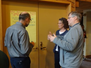
Dangerous currents workshop participants discuss community information needs on the topic. Image by Marie Zhuikov, Wisconsin Sea Grant.
After hearing about the current state of rip current education activities along the South Shore and in Port Washington, Wisconsin, participants offered their input about what resources are needed in their communities to ensure water safety. Wisconsin Sea Grant Social Science Outreach Specialist Deidre Peroff divided attendees into six groups, spread across the room, each in front of a flip chart with a different question on it. They spent the afternoon switching between questions and offering their answers.
Todd Breiby, coastal nonpoint control and education coordinator with the Wisconsin Coastal Management Program, wrapped everything up, promising to share the public input with “the family” so that it can help direct outreach efforts.
Funding for the dangerous currents project is provided by the Wisconsin and Minnesota Sea Grant programs. Other project partners include the National Oceanic and Atmospheric Administration’s National Weather Service, the Wisconsin Coastal Management Program, the Great Lakes Environmental Research Laboratory; the University of Minnesota and the University of Minnesota Duluth, the Natural Resources Research Institute and the University of Wisconsin-Madison.