What was lost will be restored again.
Way back in the 1960s and ‘70s, Cat, Willow and the Bass Islands—collectively known as the Cat Island chain—served as a beautiful and natural barrier to the waves that buffeted the harbor of Green Bay, as well as the wetland home to a long list of wildlife and plant species. At one point, thirteen species of water birds had nesting colonies on Cat Island—the greatest colonial bird diversity of any island in the Great Lakes at that time.
Then Mother Nature screwed it all up.
Floods caused by historically high water levels and aggressive spring storms during ice-breakups began eroding the islands in the early 1970s. Within a decade, the entire chain was largely obliterated, submerged beneath the waves or washed away. Only a remnant of the largest island, Cat Island, remains above water. More than 40 years later, thanks to a several-decades-long collaboration between the University of Wisconsin Sea Grant Institute, Brown County Port and Solid Waste Department, U.S. Army Corps of Engineers, U.S. Fish & Wildlife Service, Wisconsin Department of Natural Resources (WDNR) and local conservation groups, the Cat Island chain is finally set to make a reconstructed comeback.
Vicky Harris, UW Sea Grant’s water quality and habitat restoration outreach specialist, has been waiting a long time to see it happen. She coordinated the WDNR Remedial Action Plan for Green Bay and the Fox River from 1988 until 1999 and led a team of technical and citizen advisory committees that called for restoring the Cat Island chain. UW Sea Grant’s involvement dates back even further. (See sidebar.)
“Bringing the islands back will restore both island habitat for wildlife and wetland habitat for fish,” Harris said. “The chain of barrier islands is designed to shelter nearby coastal wetlands from storm damage, allowing them to recover from decades of higher-than-average lake levels.”
Now that lake levels are nearly a foot below long-term average, the coastal wetlands are beginning to return.
It isn’t often that a restoration project manages to address multiple major environmental issues. In addition to restoring habitat, the islands provide an opportunity to beneficially reuse more than two million cubic yards of non-contaminated dredged material culled from the outer channel of Green Bay, beyond Longtail Point.
“We’re very excited. This will allow for 20 years of disposal of dredged material from the bay, “ said Steven Check, project manager with the U.S. Army Corps of Engineers responsible for helming the project. “It will also lower the cost for dredging the harbor.”
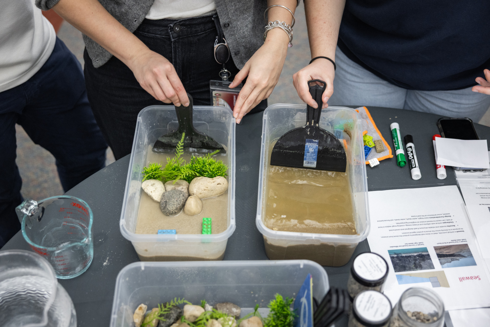
On June 1, construction crews began creating an access road that leads out into the water where the old island chain used to exist. By 2014, a spine constructed of quarried stone will be in place, serving as a barrier to waves lapping in from the northeast. Stone ribs jutting from the structure’s southwest side will create confinement zones for dredged sand, effectively recreating the islands. According to Check, the facility’s spine-and-ribs design will prevent both sediment leaching and material migration. If everything goes according to plan, the newly created islands will accommodate an estimated 2.3 million cubic yards of dredged material from the bay, creating 240 acres of island habitat and restoring 1,200 acres of adjacent wetlands.
Great Lakes Restoration Initiative (GLRI) funds have been appropriated to start this project; however, future funding is dependent on contract bids and the availability of funds appropriated by Congress.
The project will use only non-contaminated dredged material taken from the bay, not sediment from the harbor or river, material that is much more likely to have been contaminated by wastewater discharges and land runoff. Sediments from the outer bay navigation channel are mostly fine sand and contain very low or non-detectable levels of contaminants. In the past, dredged material from the bay was deposited into the Bayport Confined Disposal Facility on the south shore of the bay. That facility is designed to handle moderately contaminated material. Material that the Corps dredges from the harbor and inner bay channel will continue to be placed into the Bayport facility. Dredging for PCB clean-up is not conducted by the Corps and that material goes to specially engineered landfills.
Gene Clark, UW Sea Grant’s coastal engineering outreach specialist, also assisted the project as a technical reviewer, making sure the team understood the ramifications of the project design.
“I was sort of the bridge between the hard science and the model,” he said.
Harris is well aware that reconstructing the islands is only the first step in an ongoing process of wetlands and wildlife restoration. While the rock spine will provide some immediate wave-dampening benefits to coastal wetlands, the three separate islands in the chain will be built one at a time, over a period of at least 20 years. Area agencies and local conservation groups may be enlisted to help develop final habitat features and manage plant and wildlife communities that establish themselves on the sand islands. A big challenge may be preventing foreign invasive plant species from driving out native vegetation.
“We’ll definitely need to manage Phragmites and continue cormorant controls,” said Harris. The WDNR has committed to limiting the numbers of cormorants nesting on Green Bay to the same levels currently set in a cormorant management plan. “The island habitat will evolve naturally over time, but Mother Nature may need some help from time to time.”
After 40-plus years of planning and designing, these seem like workable challenges.
“I’d be really happy to see the first island finished,” said Harris, who’s nearing the end of a career that has spanned the life of the Cat Island project. “And to know that I had a hand in the wildlife restoration. But we’re being realistic—the restoration is likely to be a 20-year process.”
SIDEBAR
The Cat Island restoration has an additional UW Sea Grant connection: According to Harris, the original idea came from former UW Sea Grant Coastal Engineering Specialist Phil Keillor. Back in the late 1970s, Harris remembers brainstorming with Keillor about ways to reduce the wave environment and sediment resuspension in the bay. “Every time the wind blows, said Harris, “it turns the water brown.”
Before his retirement, Keillor participated with the advisory team and worked with the U.S. Army Corps of Engineers’ staff.